


TROY TOWNSHIP 01, Perry County, Indiana
About
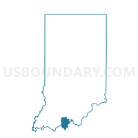
Outline

Summary
| Unique Area Identifier | 580031 |
| Name | TROY TOWNSHIP 01 |
| County | Perry County |
| State | Indiana |
| Area (square miles) | 21.01 |
| Land Area (square miles) | 20.49 |
| Water Area (square miles) | 0.51 |
| % of Land Area | 97.55 |
| % of Water Area | 2.45 |
| Latitude of the Internal Point | 37.97320370 |
| Longtitude of the Internal Point | -86.71170580 |
Maps


Graphs
Select a template below for downloading or customizing gragh for TROY TOWNSHIP 01, Perry County, Indiana


Neighbors
Neighoring Voting District (by Name) Neighboring Voting District on the Map
- ANDERSON, Perry County, IN
- HUFF, Spencer County, IN
- TELL CITY 03, Perry County, IN
- TELL CITY 04, Perry County, IN
- TELL CITY 05, Perry County, IN
- TELL CITY 06, Perry County, IN
- TELL CITY 07, Perry County, IN
- TOBIN, Perry County, IN
- TROY, Perry County, IN
- TROY TOWNSHIP 02, Perry County, IN
Top 10 Neighboring County Subdivision (by Population) Neighboring County Subdivision on the Map
- Troy township, Perry County, IN (11,965)
- Lewisport CCD, Hancock County, KY (3,471)
- Hawesville CCD, Hancock County, KY (2,578)
- Anderson township, Perry County, IN (1,557)
- Huff township, Spencer County, IN (1,156)
- Tobin township, Perry County, IN (768)
Top 10 Neighboring Place (by Population) Neighboring Place on the Map
Top 10 Neighboring Unified School District (by Population) Neighboring Unified School District on the Map
- North Spencer County School Corporation, IN (12,043)
- Tell City-Troy Township School Corporation, IN (10,417)
- Hancock County School District, KY (8,565)
- Perry Central Community School Corporation, IN (7,358)
Top 10 Neighboring State Legislative District Lower Chamber (by Population) Neighboring State Legislative District Lower Chamber on the Map
- State House District 73, IN (62,643)
- State House District 74, IN (61,219)
- State House District 18, KY (43,650)
Top 10 Neighboring State Legislative District Upper Chamber (by Population) Neighboring State Legislative District Upper Chamber on the Map
Top 10 Neighboring 111th Congressional District (by Population) Neighboring 111th Congressional District on the Map
Top 10 Neighboring Census Tract (by Population) Neighboring Census Tract on the Map
- Census Tract 9524, Perry County, IN (4,099)
- Census Tract 9525, Perry County, IN (4,092)
- Census Tract 9602, Hancock County, KY (3,471)
- Census Tract 9523, Perry County, IN (3,452)
- Census Tract 9528, Spencer County, IN (3,305)
- Census Tract 9601, Hancock County, KY (2,578)
- Census Tract 9526, Perry County, IN (2,350)
Top 10 Neighboring 5-Digit ZIP Code Tabulation Area (by Population) Neighboring 5-Digit ZIP Code Tabulation Area on the Map
- 47586, IN (10,932)
- 42348, KY (4,810)
- 42351, KY (3,851)
- 47520, IN (3,267)
- 47531, IN (1,004)
- 47588, IN (698)